Kai Werner · 22 October 2026
Scientists Deploy Permafrost Sensors on Felsgrat to Monitor Thaw Effects on Stability
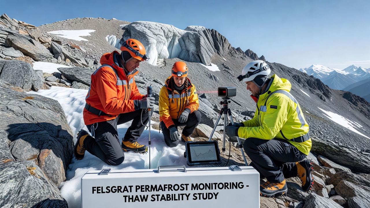
Teams from multiple research institutions have begun placing networks of temperature and moisture sensors into the permafrost layers along Felsgrat, a high alpine ridge where thawing ground ice poses increasing risks to slope stability. The effort focuses on tracking how seasonal warming alters subsurface conditions that hold rock and soil in place, with initial installations completed ahead of the 2026 monitoring season.
Why Felsgrat Matters for Permafrost Research
Felsgrat sits at elevations where permafrost persists in shaded pockets and beneath thin debris covers, conditions that researchers have mapped through prior geophysical surveys. Data from similar sites across the Alps show that ground temperatures have risen steadily since the 1990s, reducing the binding effect of ice within fractures and increasing the likelihood of rockfall during warm periods. Observers note that continuous measurements at Felsgrat will fill gaps in understanding how thaw propagates through different rock types and slope angles found along the ridge.
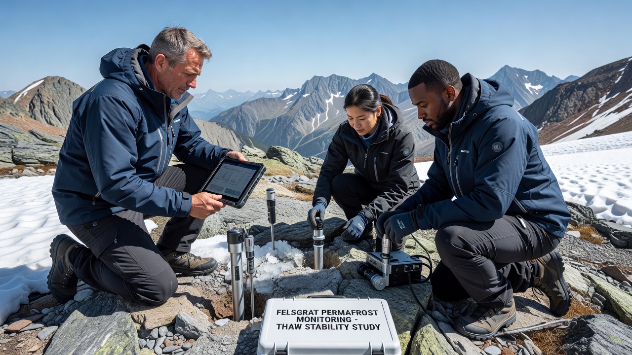
Sensors now embedded at depths between two and eight meters record hourly temperature profiles while paired probes track liquid water content and electrical conductivity. These instruments transmit readings via low-power radio links to a central logger station that uploads summaries to a shared database each day. The setup allows scientists to detect rapid changes after heavy rainfall or extended heat waves without repeated field visits.
Technology and Installation Process
Engineers selected borehole thermistor strings designed for long-term exposure in harsh alpine environments, each string containing twenty individual sensors spaced at regular intervals. Drilling teams used lightweight rigs to reach target depths while minimizing surface disturbance to fragile vegetation and lichen communities. Once lowered into place, the boreholes were backfilled with material matching the original grain size to preserve natural heat flow patterns.
Additional tiltmeters and crackmeters were fixed across visible fracture zones to measure any surface movement that coincides with subsurface warming. All equipment meets specifications used in established permafrost observatories elsewhere in Europe, ensuring compatibility with larger regional datasets. Calibration checks performed on site confirmed sensor accuracy within 0.1 degrees Celsius before final sealing.
Timeline and Data Collection Starting October 2026
Full operation of the sensor network is scheduled for October 2026, when continuous logging will begin and the first complete seasonal cycle becomes available for analysis. Researchers plan quarterly downloads during accessible months and will compare readings against meteorological records collected from nearby automatic weather stations. This overlap will help isolate the influence of air temperature spikes, snow cover duration, and precipitation intensity on ground thermal regimes.
According to the WSL Institute for Snow and Avalanche Research, similar instrument arrays in the Swiss Alps have already documented multi-year warming trends exceeding 0.5 degrees Celsius per decade at comparable depths. Felsgrat measurements will test whether local geology produces faster or slower responses than those observed at lower-latitude sites.
Integration with Broader Alpine Monitoring Efforts
The Felsgrat project links directly to the European permafrost monitoring framework coordinated through several national geological surveys. Results will feed into pan-Alpine hazard assessments that combine ground temperature data with remote sensing of surface deformation. One study published by the University of Innsbruck demonstrated that combining borehole data with InSAR satellite imagery improves detection of slow-moving rockslides triggered by thawing permafrost, an approach the new sensors will support at finer spatial scales.
Project leads have coordinated with local land managers to ensure sensor placements avoid protected botanical zones identified in earlier surveys. Access routes for maintenance visits follow established paths, and all surface equipment carries reflective markings for winter visibility. These steps align with existing environmental protocols used across multiple alpine research sites.
Expected Insights and Applications
Over the coming years the dataset will reveal how quickly thaw fronts advance during successive warm summers and whether certain fracture orientations accelerate ice loss. Such patterns matter for updating stability models used by authorities responsible for trail maintenance and infrastructure planning along the ridge. Real-time alerts generated from threshold exceedances could also inform temporary access restrictions during periods of elevated risk.
Researchers emphasize that the sensors provide raw measurements rather than predictions, leaving interpretation to subsequent modeling work. Comparisons with historical temperature profiles collected manually in the early 2000s will quantify the rate of change at Felsgrat specifically, adding a high-resolution case study to the wider European record.
Conclusion
The deployment of permafrost sensors on Felsgrat establishes a new long-term observation point that connects local thaw dynamics to regional stability concerns. Starting in October 2026, continuous data streams will support improved understanding of how warming ground ice affects alpine terrain, contributing to hazard evaluation frameworks already in use across the Alps. The project demonstrates how targeted instrumentation can extend existing monitoring networks without duplicating prior survey efforts.